Kate Carlson (Geography), Micaella Penning (GAC), Britta Hardel (GAC)
Funded by City of Duluth, $15,574
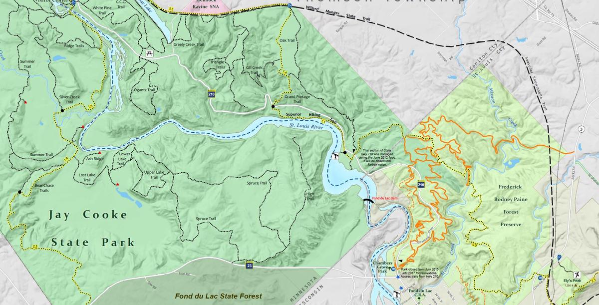
This project consisted of GIS integration, cartography, layout and design of a Duluth Area Multi-use Trail map. Trail use (bike, hike, paddle, ski trails, including the Superior Hiking Trail and Duluth Grand Traverse) was designated with different colors. City park amenities, swimming, fishing and birding areas were included as well as numerous other recreation opportunities.
For more information about Duluth Parks and a PDF version of the map, see: http://www.duluthmn.gov/parks/ or stop by the Geospatial Analysis Center for a free hard copy!