Stacey Stark (GAC), Steve Graham (GAC), Micaella Penning (GAC)
Funded in-house
The Geospatial Analysis Center (GAC) is fostering collaborations with classes across the University, including Writing Studies, Journalism, French Literature, Math, Ethnobotany, Ecology, and Anthropology. Through presentations, demonstrations, and hands-on tutorials, students are learning to harness the power of web mapping using ArcGIS Online. Students with no prior cartographic experience create media-rich story maps, analyze and visualize quantitative and qualitative data, and learn about real-world examples of how GIS and web mapping are being utilized by professionals in their field.
The advent of ArcGIS Online opened an access point for non-geographers from an array of fields. In an effort to expand GIS services across campus, GAC gave presentations to various departments in the College of Liberal Arts, including Political Science, American Indian Studies, Communications, Sociology, History, Anthropology, Writing Studies and Journalism. The goal of these presentations was to foster new cross-disciplinary connections throughout the college, increase campus awareness of GAC and its mission, and demonstrate the wide scope of geographic information science in the hope of initiating new collaborations.
Students in Kenneth Marunowski's class Literacy, Technology, and Society created story maps based on their textbook, How Writing Came About, by archaeologist Denise Schmandt-Besserat, in which she describes her theory that cuneiform script invented in the fourth millennium B.C. derived from tokens, an archaic counting device. Despite the geographic nature of her research, the book contains only one map, a simple black outline of the Middle East, with small black symbols denoting sites where tokens were found. The map lacks all essence of modern cartography, yet it confirmed the spatial nature of the book's information, and the potential to utilize web mapping to enliven the text was immediately evident. Examples of students' web maps are linked below:
"How Writing Came About" A Mapping Exercise
Visual History Map of How Writing Came About
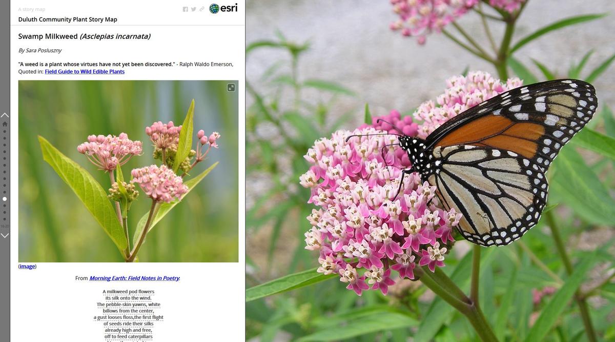
During the fall semester of 2015, Professor David Syring (Anthropology) collaborated with GAC to create a Duluth Community Plant Story Map with his ethnobotany class. His students worked to answer the following questions: What plants to people pay attention to? What plants have a traditional use as food or medicine? Students integrated their research into a Story Map that will serve as a community resource, and be added to by future ethnobotany students and local residents. A KUMD interview with Syring about the project is available.
Check out the story map here! The community is also invited to participate by submitting suggestions and additions as the Story Map evolves.